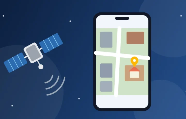
You can see your house's roof or the street where you grew up from above, directly on your phone and for free. There's one detail almost no one mentions: these images are not live. They are photos taken by satellites and airplanes at some point in the past. Here we show the official apps for seeing any place from above and from the street, how to find out when the photo was taken, and where to find truly recent images.
Ratings, downloads and functionality checked on Google Play, the App Store and official help pages on November 4, 2026.
In a few words
- Google Earth): 3D globe, with old images to compare.
- Google Maps: Satellite layer and Street View, with street photos from other years in many places.
- Apple Maps: satellite and 3D on iPhone; Apple's street view is not yet available in every country.
- Copernicus Browser and NASA Worldview: images from days or hours ago, without detail for seeing a house.
- No app shows your house live by satellite.
First, the truth: there is no live satellite view of your house
The official help for Google Earth is direct: the images are not in real time, so you won't see changes happening. The detailed photos, which show roofs and backyards, are taken by cameras on satellites and airplanes, each on a specific date, and then assembled into a mosaic. That's why it's common to see a car that has already been sold or a construction project that's already finished.
Recent imagery does exist, but it's something else. Some satellites photograph the same region every few days and others cover the whole planet every day. For this, each point in the image (the pixel) represents a large patch of ground: 10 meters in the best case among the free services in this guide, and hundreds of meters in the daily images. You can follow a flood or a fire, but not see a house, a car or a person.
The apps for seeing your house from above and from the street
1. Google Earth: the globe with old images
The Google Earth is free on Android, iPhone and the browser, at earth.google.com. You type in the address and the app flies there, with buildings and terrain in 3D in hundreds of cities, according to the store description. You can also zoom down to the street with Street View.
The most interesting feature is the timeline. According to Google's official blog, since 2024 historical images are available in the web and mobile app, and in some places go back 80 years. The path in the official documentation:
- Search for the address.
- Set the base map to Satellite: the timeline doesn't work in Map mode.
- In the toolbar, tap Historical imagery.
- Choose a year on the timeline or use the arrows. The dots mark years, and smaller dots, extra months.
- To go back to the newest image, use the button that locks the most recent image.
Note: according to Google's documentation, seeing the date of the current image is not yet possible in the mobile app. To find out when the photo was taken, open Google Earth in a computer browser and hover over the place: the date appears in the bottom bar. In mosaics, it changes as the cursor moves, and it doesn't appear on 3D images. On Google Play, the app has no ads or purchases.
Google Earth
Rating 3.8 on Google Play · over 500 million downloads · Free
2. Google Maps: satellite and street view in the app you already have
On Android, the Google Maps almost always comes preinstalled; on iPhone, it's free on the App Store. To switch the drawn map to satellite photo, tap Layers in the upper right corner and choose Satellite. In settings, the Start in satellite view option keeps that view fixed. Google's help warns that it uses more data than the regular map.
To see the facade, enable Street View under Layers: the blue lines show streets with photos, and you just tap one. The trick few people know: in many places See more dates appears, a carousel with photos of the same street from other times. You can see the house before a renovation or how the neighborhood changed, but the help warns these old photos don't exist everywhere.
Note: the help for Google Maps doesn't describe how to see the date of the satellite photo in the app; for that, use the Google Earth on a computer. If the image is very old, there is a form to report it, but Google doesn't promise a timeframe. On Google Play, the app appears marked as containing ads.
Google Maps
Rating 3.3 on Google Play · over 10 billion downloads · Free
3. Apple Maps: 3D satellite on iPhone
On iPhone and iPad, Apple's Maps app, the Apple Maps, comes preinstalled. Tap the map modes button on the right side of the screen and choose Satellite. According to the iPhone User Guide, in most cities you just zoom in and drag two fingers up to see the map in 3D, made with aerial imagery.
Apple's street view is called Look Around (Look Around): a 360-degree image opened by a button near the bottom of the map, where coverage exists.
Note: on Apple's official availability list, checked today, Look Around appears in countries such as Mexico, Spain, Portugal and Canada and in dozens of cities in the United States and Japan, but not in every country: check Apple's list for yours before looking for the button. The help doesn't describe how to see the date of the images, and the app doesn't exist for Android.
Recent imagery: services from space agencies
To know how a place looks now, and not two years ago, there are two official, free options. They work in the browser on your phone or computer, with no store app, and neither shows house-level detail.
Copernicus Browser: the world every few days
The Copernicus Browser, at dataspace.copernicus.eu/browser, shows images from satellites Sentinel, from the European program Copernicus. According to the documentation, you need to create a free account.
The satellites Sentinel-2 take color photos with 10-meter pixels and, with two satellites, return to the same spot every 5 days at the Equator and every 2 or 3 days at mid-latitudes. Clouds in the way hide the ground. By our count, an ordinary house occupies one or two pixels: you can see the neighborhood, a reservoir or a new subdivision, but not the backyard.
Find the place, keep the collection Sentinel-2 L2A and use the button for the most recent date (Show latest date, in the English version). By default, only images with up to 30% cloud cover are included. Each image is from a single day, and the search lets you choose the period; there is an archive going back to 2015.
NASA Worldview: the planet today, seen from afar
The NASA Worldview, at worldview.earthdata.nasa.gov, brings together more than 1,200 satellite products. According to the NASA, many layers are updated up to three hours after observation, and the site was built to work on mobile phones. You can go back to earlier dates and animate the sequence. The daily true-color image has 250 meters per pixel: each point covers more than a city block.
There are also layers from geostationary satellites, which arrive at 10-minute intervals, with the last 90 days stored. It is the closest thing to "live" available to the public: great for watching a storm or wildfire smoke, useless for seeing a house.
Quick comparison
| Service | Where it works | What it shows | Date and history |
|---|---|---|---|
| Google Earth | Android, iPhone and browser | Satellite, 3D and street view | Date on computer; historical images |
| Google Maps | Android, iPhone and browser | Satellite and street view | Street photos from other years in many places |
| Apple Maps | iPhone, iPad and Mac | Satellite, 3D and street view (in some countries) | Not described in the help |
| Copernicus Browser | Browser, with a free account | Images from a few days ago, 10 m pixel | Each image has a date; archive since 2015 |
| NASA Worldview | Browser | Daily image, 250 m pixel | Many layers within 3 hours; earlier dates and animation |
How to ask for your house to be blurred on Street View
Google already blurs faces and license plates automatically, and you can request blurring of your house, your car or yourself. According to the official help, only the owner or tenant can request blurring of a house, with proof of address.
- On Google Mapsopen the photo of the Street View of your house.
- Tap Report a problem; on mobile, if it is not visible, look in the More menu.
- Choose My house and confirm that you are authorized to request it.
- Send the proof, type the address and submit the form.
Accepted documents include a utility bill, bank statement or letter with the address, dated within six months, as well as a rental contract, home insurance or property tax record. Cover names and account numbers, leaving the address and date visible. Identity documents are not accepted. Google says it deletes the documents after 60 days.
Think first: blurring is permanent. And the help warns that Immersive View does not use the photos from the Street View, so the blur does not apply there.
On Apple Maps, Apple says it blurs faces and license plates in Look Around and receives requests to blur one's own house through the contact on the official page. maps.apple.com/imagecollection.
Beware of "live satellite" apps
Search for "satellite" in the store and dozens of apps with "live" in the name appear. In our research, several show ads and sell in-app purchases. Since no public source offers live detailed imagery, the promise does not hold up. Be wary when the app:
- Promises to show your house, a car or a person live.
- Asks for a subscription on the first screen, sometimes with a "free trial" that turns into a charge.
- Asks for access to contacts, SMS or microphone, which have nothing to do with maps.
- Claims to track a person by satellite or by phone number.
Tracking someone by satellite is not a service available to the public. A person's location only appears when they themselves decide to share it: on Google, Location Sharing is off by default and the person chooses whom to share with. Subscribed by mistake? Cancel in the store's subscriptions area; the Google Play help notes that uninstalling the app does not cancel the charge.
How to install safely
Download only from Google Play or the App Store, never from APK files on websites or groups, which may have been altered to steal data.
- On Android: in Google Play, check the developer below the name: on the Google Earth and the Google Maps, it is Google LLC. There are imitations with similar names.
- On iPhone: in the App Store, the developer of both is Google. The Google Earth requires iOS 17 or later, and the Google Maps, iOS 16. If you deleted the Apple Maps, download it again from the App Store.
- Location: is only needed to see where you are; to look at an address you typed, it is not necessary.
Privacy: looking is not watching
Checking a hotel entrance or revisiting the street of your childhood is normal use. Using these images to watch, intimidate or stalk someone is another matter, and in many countries stalking is a crime. Do not publish another person's house facade together with its address.
Remember that your house is also visible to anyone: if that bothers you, request blurring. Avoid posting a screenshot of the map showing the exact place where you live. And since satellite views use more data, prefer exploring on Wi-Fi.
Frequently asked questions
Can I see my house live by satellite?
No. The detailed images of the Google Earth, of the Google Maps and of the Apple Maps are photos of the past. The most recent ones, from hours or a few days ago, have a 10-meter pixel or coarser and do not show a house in detail.
Why is the image of my street so old?
The photos come from providers, at different times, and only later enter the map. Google does not promise an update schedule, but it accepts outdated-image reports through the help of the Google Maps. It is worth opening the historical images of the Google Earth, which show the available dates for the place.
Can I see people or cars in the images?
In detailed photos cars sometimes appear, but they are from the day of the photo, not from now. On Street View and in Look Around, faces and license plates are blurred. In recent images of the Copernicus Browser and of the NASA Worldview, a car is smaller than a pixel.
Do I need to pay for anything?
No. All the apps and services in this guide are free; the Google Maps shows ads and the Copernicus Browser asks for a free account. If an app charges a subscription to show your house, prefer the official options.
Want more? The Apps category gathers other practical app guides, and the Curiosities section has readings on technology, space and the world seen from above.